
Creating the ImageNet of satellite imagery
We introduce the Functional Map of the World (fMoW) dataset, which includes over a million satellite images from more than 200 countries, labeled with functional building and land use categories. The dataset is designed to support machine learning research that combines visual data with rich metadata such as location, time, and sun angle. With bounding box annotations, temporal views, and baseline models, fMoW aims to serve as a foundational resource for geospatial AI in the same way ImageNet did for computer vision.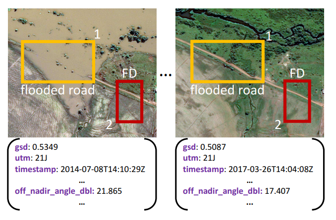
More content coming soon...